The Northernmost Point of the Contiguous U.S. ...Is Only Accessible Via Canada?

A painted marker signifies the northernmost point of the Lower 48 states (Photo: John Enger, MPR News)
*Post updated on June 2, 2025
If you asked 100 random people on the street what the southernmost point of the contiguous U.S. is, perhaps 50 to 60 of them could correctly tell you that Key West, Florida, is the destination you’re after. What would happen, though, if you asked the same group to name the northernmost point? Would the number of correct responses be similar? Higher? Lower? If I were betting on it, I’d certainly take the under.
The northernmost point in the entire U.S. would be Point Barrow, a short slog north of Utqiagvik, Alaska, all the way up in the Arctic Circle. But that’s not the answer we’re looking for here, is it? No, because we are confining ourselves to the contiguous U.S., which means our attention is focused on the Lower 48. So what is the proverbial North Star, then?
Well, friend, for the answer to that question, pull out your map of the U.S. and take a peek at the great state of Minnesota, specifically at its northern border. See that odd little piece of land surrounded by Canada on three sides and cut off from the rest of the state by water? That’s the Northwest Angle, a 123-square-mile section of Minnesota located in a county called Lake of the Woods, which also happens to be the furthest north you can travel in the contiguous U.S. before entering the friendly confines of our northern neighbor.
The only thing is… you actually have to drive through Canada in order to get there. Cut off from the rest of Minnesota, and by extension, the rest of the U.S., by the county’s namesake body of water, the Northwest Angle is only accessible by land via roadways that pass through the Canadian province of Manitoba.

Location of the Northwest Angle (Image: Wikimedia Commons)
The U.S. has a handful of de facto exclaves, but the story behind the Northwest Angle and how it came to be part of the Lower 48, rather than a small extension of Canada, is certainly unique. William E. Lass, professor emeritus of history at Minnesota State University-Mankato, boiled it all down into a single sentence in an explainer published in MinnPost in 2014, saying simply: “Treaty negotiations based on faulty maps can have odd results.”
Things got started with the Treaty of Paris of 1783 between the upstart U.S. and the young country’s nemesis in the Revolutionary War — Great Britain. The Brits agreed to a U.S.-Canada border stretching from the Atlantic Ocean west to the Mississippi River and as far north as the northwesternmost point of Lake of the Woods (the body of water), which had not been properly mapped at the time. The border was then to continue due west from Lake of the Woods over to the mighty Mississippi.
The issue there, as I alluded to a second ago, is that the fine folks who drew up this treaty demarcating the international border were working off a map that did not accurately depict the size and shape of Lake of the Woods. “They accepted map maker John Mitchell’s depiction of an egg-shaped Lake of the Woods that had an obvious northwesternmost point,” writes Lass. “They also believed Mitchell’s claim that a line drawn due west from there would intersect the Mississippi.” But, oh, were they mistaken.
A solid 15 years later, in 1798, a British explorer discovered that the source of the Mississippi River was actually found about 150 miles south of Lake of the Woods, at Lake Itasca. This meant that a border gap — the 150 miles separating the two lakes — existed in what should have been the northwest corner of the U.S. And obviously, because international borders are important or something, this had to be remedied.
The British proposed the sensible solution, which would have seen the border cut through the southern portion of Lake of the Woods, giving the northern half of the lake, and the Northwest Angle, to Canada, and avoiding the creation of the American exclave that exists today. But the Americans, stubborn as they were (and continue to be, I might add), weren’t having any of it.
The second proposal from the British involved drawing a north-south line from the northwesternmost point of Lake of the Woods down to the 49th parallel. Any further extensions to the west of that point would then follow the 49th all the way to the Pacific Ocean, if necessary. The U.S. initially shot down this proposal, as well — only to change their minds about a decade later and go forward with it.
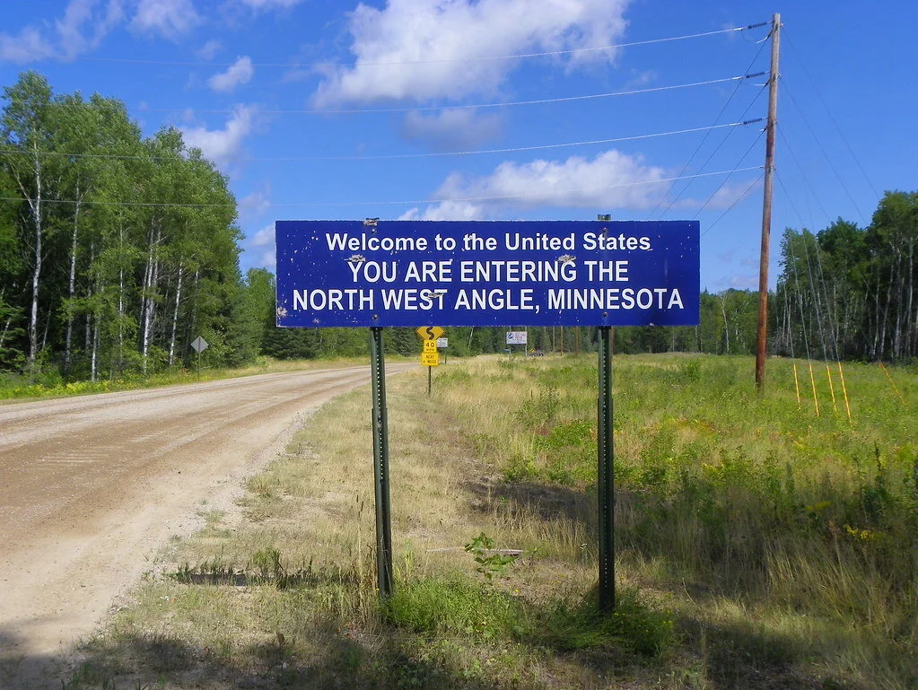
This lovely sign greets travelers as they cross from Manitoba into the little slice of Minnesota known as the Northwest Angle (Photo: Flickr)
So, problem solved, right? The U.S.-Canada border gap was closed and everyone lived happily ever after. Well, yes, sure, but they lived happily ever after without realizing the very strange-looking boundary they had just agreed to. Because even then, in the early 1800s, the actual shape of Lake of the Woods was still a mystery. What’s more, no one truly knew where the 49th parallel was relative to the lake’s northwesternmost point.
It wasn’t until about three decades later, in the 1840s, after surveyors finally figured out the actual lay of the land, that U.S., British, and Canadian officials discovered the result of their border agreement: a very funny-looking bump along the official boundary line, and the creation of the Northwest Angle, a tiny slice of America separated from the mainland by Lake of the Woods. Upon this realization, Great Britain and Canada attempted to proposition the U.S. to sell the angle to Canada, effectively remedying the exclave situation, but once again, the U.S. wouldn’t have it. “The Americans realized that it did not have great economic value,” notes Lass, the history professor. “But they persisted in rejecting anything that would change the treaty under which they had gained their independence.” And so it remained.
These days, a joint U.S.-Canada boundary commission manages the border crossing where Manitoba’s Provincial Road 525 and Minnesota’s Winter Road meet (along that north-south divide running from the northwesternmost point of Lake of the Woods down to the 49th parallel). The crossing itself is unstaffed, which is why travelers are directed to drive up into the area known as Angle Inlet and use the phone at Jim’s Corner, Young’s Bay Resort, or Carlson’s Landing to contact Canadian or U.S. Customs and make their declarations. The same procedure needs to be followed on the way out, as well.
Once there, you have a few options for overnight accommodations. These include Prothero’s Post Resort, Angle Outpost Resort, and the aforementioned Carlson’s Landing. Recreation-wise, if you’re coming up here, you’re probably going fishing or simply looking to enjoy the natural beauty and wildlife of this exceedingly remote location, but if you’re in need of some other frills, the Northwest Angle Country Club has a 9-hole course available for your golf-ball-whacking needs. Snowmobiling across a frozen-over Lake of the Woods (and thereby skirting the international border crossing) in the wintertime is also a popular activity.
Bottom line: if you’re a nature lover, visiting this quirky Minnesota outpost should be on your list.
-LTH