13 Reasons Why You Need to Visit Pictured Rocks National Lakeshore
Jumping from Lovers' Leap is not recommended — even if you're both head over heels
*Post updated on May 23, 2023
Michigan, in 1966, became the first state in the nation to have one of its shorelines designated a National Lakeshore, as declared by Congress. Extending 42 miles and covering more than 73,000 acres along Lake Superior's southern shore, Pictured Rocks National Lakeshore contains 15 miles of colorful sandstone cliffs, water-carved caves, arches, and other rock formations, as well as five miles of sandy dunes decorated here and there with jack pine forests.
Pictured Rocks has attracted more than 25 million visitors since 1973, according to statistics maintained by the National Park Service, including over a million apiece in 2020 and 2021 — and it's no secret why people flock to these somewhat far-flung shores in Michigan's Upper Peninsula. Instead of attempting to describe their beauty, I thought a much more poignant way to show just how magnificent they are would be to let them speak for themselves.
Here, in all of its sandstone-y glory, is Pictured Rocks National Lakeshore:
It would be difficult to decipher which of Pictured Rocks' features is most famous, but there is only one that has been used as the site of a wedding ceremony — and that would be Miners Castle. Receiving its name from Englishmen in search of minerals in 1771, the Castle has towered along the shoreline for centuries and even served as a major inspiration for Henry Wadsworth Longfellow's 1855 poem "The Song of Hiawatha".
Sticking out like the bows (or sterns?) of ships, these cliffs near Chapel Beach are known as Battleship Row. They may be less famous, perhaps, than Miners Castle and some of the other rock formations along the lakeshore, but at least they can hold their heads up high knowing they would completely destroy that puny pontoon in naval warfare.
Looking stern and stoney, the face of what appears to be a Native American chief juts out into the waters of Lake Superior at what is known as Indian Head Point. When we reached the spot during our morning boat ride with Pictured Rocks Cruises, a company based in Munising, the sun was hitting the cliff just so, making the face rather easy to pick out.
Getting its name for obvious reasons, the Flower Vase sits between Battleship Row and another rock formation called Indian Drum, which is comprised of three percussive-looking rocks that one could imagine being played by giants. Any adventurous souls looking to get within actual striking distance of any of Pictured Rocks' colorful cliffs may want to consider a kayaking tour, such as the one offered by Pictured Rocks Kayaking.
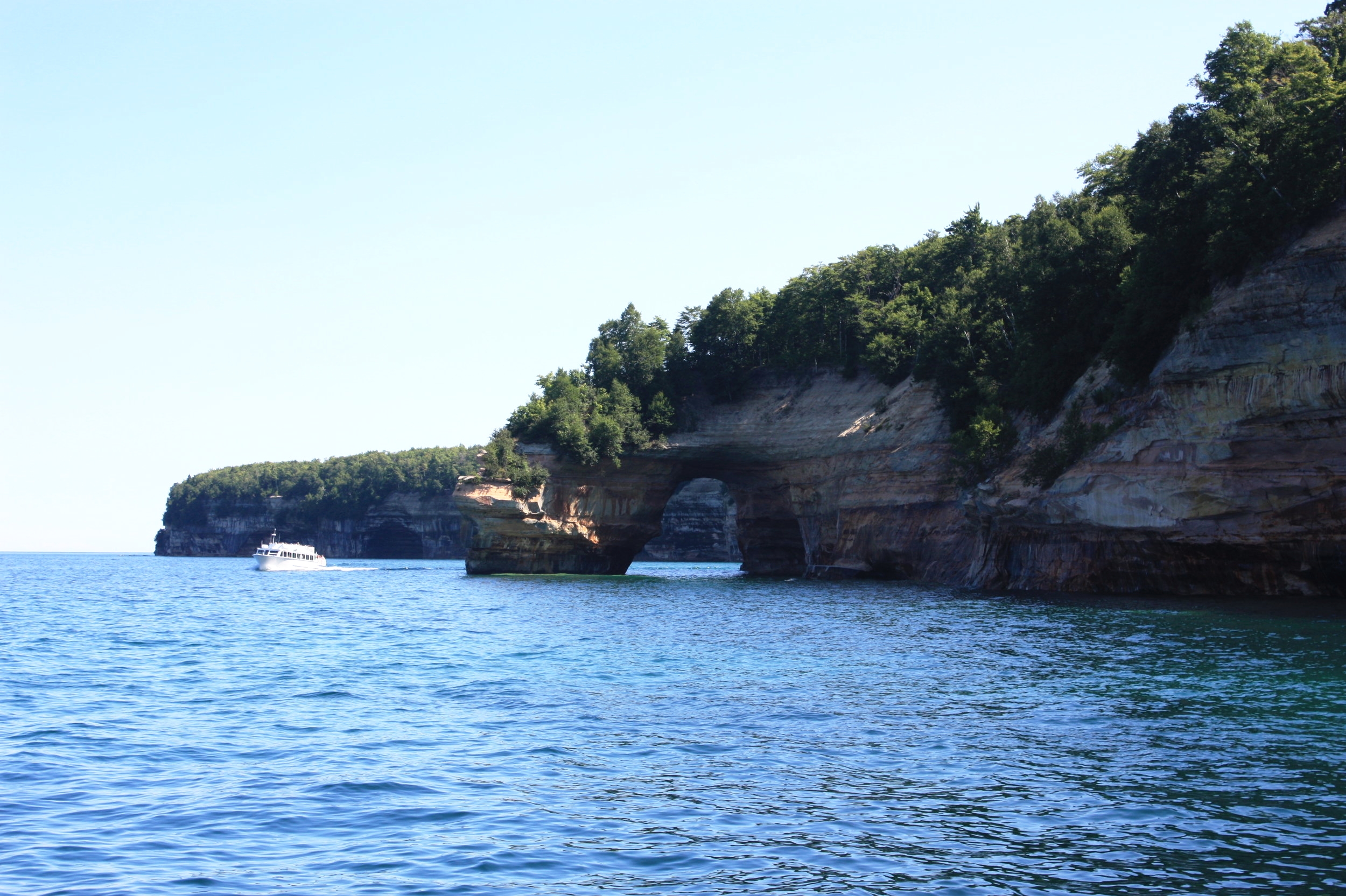
Speaking of kayakers, I spy a group of paddlers heading by Lovers' Leap, a formation rumored to have gotten its name from a couple displaying their affection for one another by jumping from the arch into the often chilly waters of Lake Superior. Experts do not recommend that specific brand of P.D.A these days, as the water at the base of the arch is only a few feet deep.
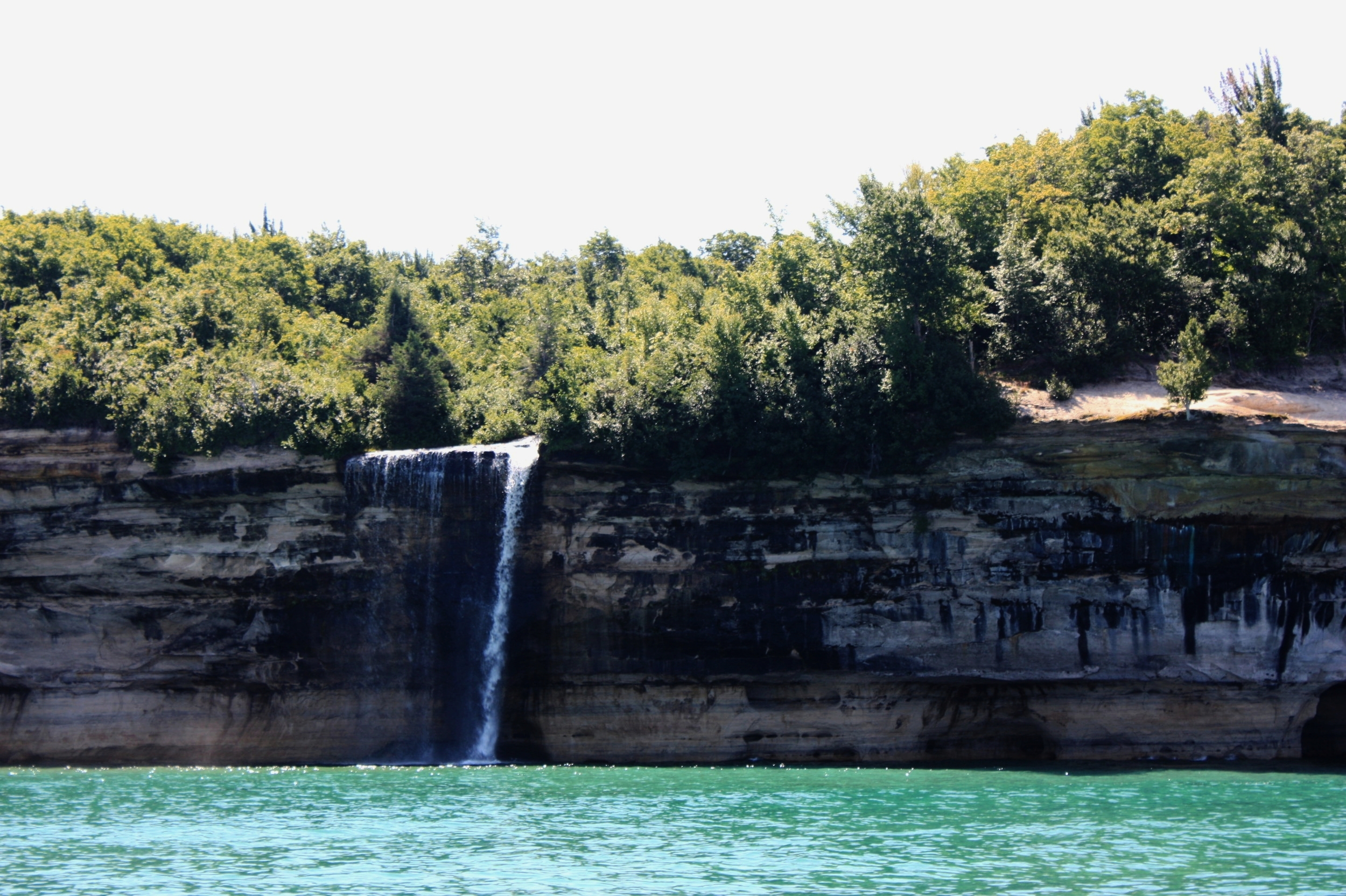
There are a few waterfalls along Pictured Rocks National Lakeshore that constantly quench Lake Superior's thirst, including this little fella, Spray Falls, which is best viewed by boat. Fun fact: the remains of a ship named "Superior," which sank in 1856, lie at the base of Spray Falls in about 20 feet of water.
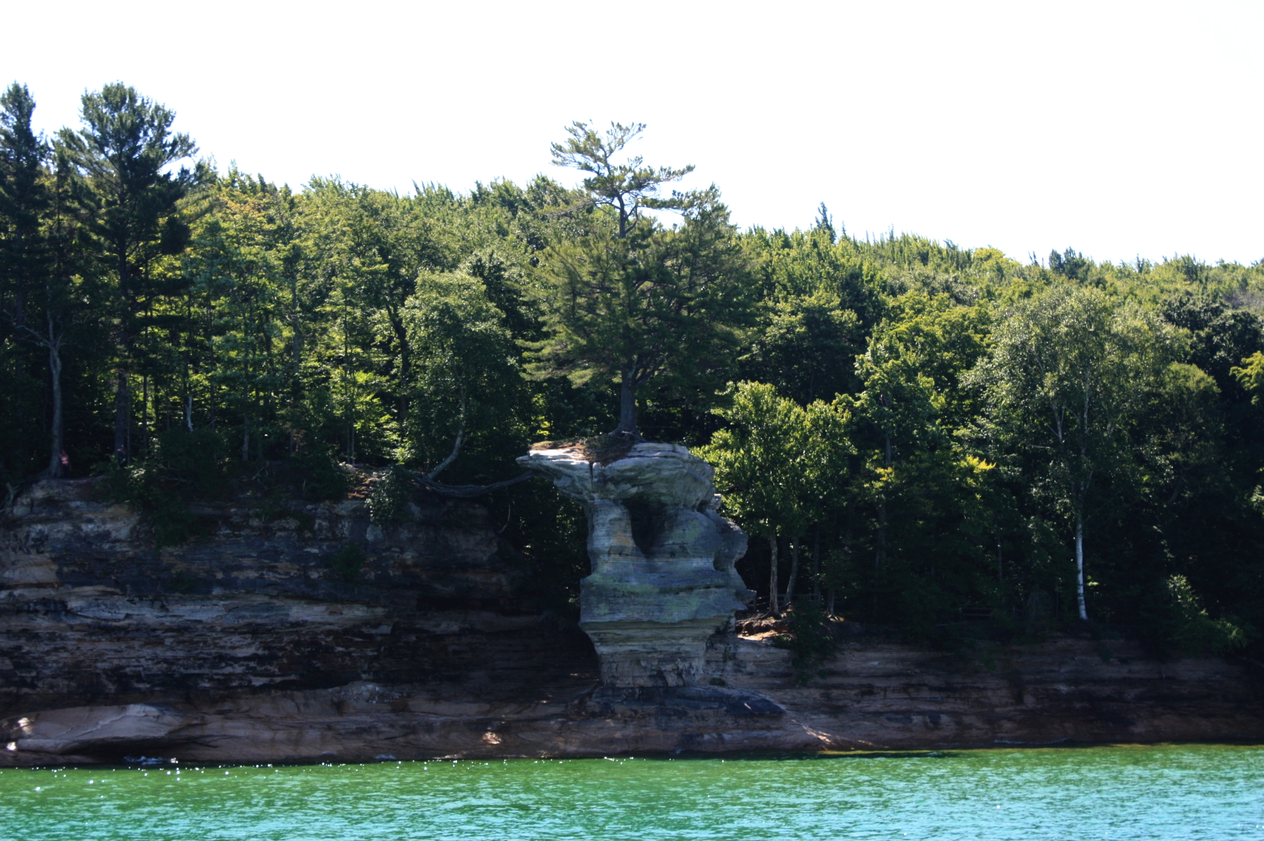
One of the most neat-o gang rock formations along the lakeshore happens to be Chapel Rock, an altar, if you will, holding up a single tree very near Chapel Beach. Hiking the Chapel Loop, a 10.4-mile trail that passes by two waterfalls, is a great way to get up close and personal with Chapel Rock, where you will be able to truly appreciate the formation's sole occupant's will to survive. Just look at those roots reaching back to the forest and all of its nutrient-rich soil.
I don't know who this woman is nor if she will mind having the back of her head featured in a blog post, but would you just look at how well those colors play off each other? WOULD YOU JUST LOOK AT IT?! How could I not take this photo?
In addition to boat and kayak tours, visitors to the lakeshore also have the option of renting a pontoon to cruise past the painted rocks at their own leisure. A couple of outfits offering rentals include Superior Pontoon Rentals and Seaberg Pontoon Rentals.
Part of our tour with Pictured Rocks Cruises took us by Grand Island, a fairly large island just off shore from Munising, and this lighthouse that sits along the island's eastern shore. Called the East Channel Lighthouse, the small structure was apparently once home to a light keeper, his wife, and their 12 children (yikes, am I right?). Never proving very visible to ships coming into Munising's harbor from Lake Superior, the lighthouse has been out of commission for over 100 years.
While viewing Miners Castle by boat is a pleasant enough experience, you can also drive just east of Munising and head down Miners Castle Road where the National Park Service maintains a pair of scenic overlooks and a visitors center. Resist the urge to jump the railing and climb up onto the Castle, however — you'd probably rather not end up like the man who was fined $690 for doing just that in 2018.
And finally...
Check out this ultra-brief video, which features two rock formations mentioned above: Battleship Row and the Flower Vase. (And then start planning your trip, obviously.)
-LTH


